Friday 30 November 2007

"Switch back" topography

There were a couple of nasty surprises for Mark today - the condition of his wheel was the first but having repaired that, he then had to face what he describes in the diary as the 'switch back' hills to the east of Adelaide. I have done a bit of investigation about the hills and here's what I have unearthed. You can see on the aerial view above that the southeastern suburbs of Adelaine end fairly abruptly along a line which coincides with some accentuated relief. It is so marked that I would go as far as to say that the city is hemmed in by the range of hills. These are the Mount Lofty Ranges which separate Adelaide and the Adelaide Plains from the lowlands of the River Murray to the east. And yes, it does look very 'uppy downy' as you can see when you zoom in a little.

The problem with aerial views like this when you want to look at relief is that they flatten the hills. You have to look for clues like the hairpin bends and tunnels to really understand what you are looking at. Clearly, from Mark's description of being two hours in low gear, the road across the Mount Lofty ranges is very steep!

The summit of Mt Lofty provides some pretty good views back down to Adelaide and gives an indication of just how high Mark had to climb today ... It will be no consolation to Mark that the east side (downhill for him) is much less steep. There is a good geological explanation.....
The Mount Lofty ranges form the eastern rim of a large syncline (downfold or basin of sedimentary rocks). However, the topography is complicated by the fact that there are also a number of active faults in the Mount Lofty Ranges and these have allowed sections of the crust to slip downhill as in this diagram. It is apparently a very complicated fault zone in which there is still regular minor seismic activity. This type of faulting results in a series of steps in the landscape - downthrown blocks, some with reverse tilt which give the 'switch back' topography described by Mark. And below.... one of those steps .....

Thursday 29 November 2007

Adelaide

Just a quick posting from Adelaide before Mark sets off after his 'rest' day. Here is a general location map of the area around Adelaide with Mark's bike 'parked' at Dublin ready for the off!
It is impossible to write about the 'Geography of Adelaide' in a blog - there's just too much of it!However, if you are so inclined, you can read plenty about the city here. In addition, if you look at it on Google Earth as below, you will see that there is a dense layer of photos to explore..You cannot, however, zoom in on the centre of Adelaide without being struck by the layout of the city.... the grid pattern, the rectangular city centre but most of all by the green belt surrounding the CBD. In my experience, this is quite unique - not even rivalled by Central Park in New York . The explanation for this intriguing layout is shown below...

The layout of Adelaide was designed by the first surveyor-general of South Australia, Colonel William Light. His plan, now known as Light's Vision, arranged Adelaide in a grid, with five squares in the inner city of Adelaide and a ring of parks known as the Adelaide Parklands surrounding it. Below is an aerial view of the city centre of Adelaide with the 'Oval' cricket ground occupying part of the green belt land.


...and a view of the CBD from the adjacent Parkland...


Dublin...or not!

Mark's in Dublin! Not the Dublin, of course, but one which is located about 50km north of Adelaide and where he last 'reported in' via his GPS tracker before having a day off in Adelaide.

Dublin is a small town on the agricultural Adelaide Plains which extend north of the city of Adelaide. The entry in Wikipedia marks it out as a small service centre but with a growing community of commuters. The view below gives an indication of a very ordered, almost planned, layout with metalled roads giving way to unmade streets where new housing is being erected on a very regular grid pattern. The tight planning even extends to the square belt of parkland around the perimeter of the town......
The landscape around Dublin is almost exclusively farmland and it is predominantly wheat country as this view of the north Adelaide Plains shows. A little closer to Adelaide, and simply called Adelaide Plains is one of South Australia's wine regions. Click the link to read about wines from the region.

And here, some of the vines which become more abundant closer to Adelaide.

Tuesday 27 November 2007

Grasping the metal

As Mark approached Whyalla along the Lincoln Highway yesterday, he was probably quite unaware of several large 'holes in the ground' just a few miles to the west, in a range of hills known as the Middleback Ranges.....
These are the Iron Duke mines, a source of iron ore which has been hugely important in the history of Whyalla where Mark overnighted yesterday.

Whyalla's original purpose in life was as a transhipment port (built in 1901) for iron ore bound for the lead smelters (where it was used as a flux in the furnaces) at Port Pirie on the other side of the Spencer Gulf where Mark has ended today's leg. In 1920 its importance increased as it started exporting ore to the steelworks at Newcastle, New South Wales.
Incidentally, by some curious coincidence, I have just typed 'Newcastle' as the train I am on has arrived at Newcastle station (not the one in Australia!). Modern digital technology never ceases to amaze me. Blogging wifi on a train.....I'd never have imagined that would be possible even five years ago!
Whyalla's real rise to fame began around 1939 when a blast furnace was built at the port. This is very typical of the sequence of events associated with iron and steel production worldwide. In the early years of production, more coal was required than iron ore to produce one tonne of steel. Hence, the early steelworks were located on the coalfields such as at Newcastle. More recent steelmaking technology demanded more iron ore than coal and as both are bulky commodities, it was better to shift production to near the iron ore. Hence the opening of the blast furnace in Whyalla and subsequent location nearby of the Australian naval shipyards (using the sheet steel produced there). The late 20th century saw the closure of the shipyards and a rationalisation of the steel industry (sound familiar?). Today, steel is still produced in Whyalla but in much smaller quantities than previously and some ore is still exported. The legacy of the industrial history is, however, clearly visible from the air and on the ground....

Incidentally, it is worth considering how a large town with a population of 20,000 in a very arid area supplies its residents with water. The answer in the case of Whyalla is via two huge pipelines which bring water from the Murray River on the other side of the Spencer Gulf.

Having reached the northern end of he gulf at Port Augusta, Mark has now headed south towards Adelaide and has stoped at Port Pirie for the night. Port Pirie has the dubious distinction of having the largest lead smelter in the world - a fact you can easily believe when you see the size of its chimney which, at 205m, is the tallest structure in the state of South Australia.

Monday 26 November 2007

Desert again?

It was quite a surprise to zoom in on the tracker today and to find that I was looking at semi desert again.....In fact, if you draw back and look at the area from further 'away' you can clearly see how cultivation in the southern part of the Eyre peninsula gives way to scrubland as you go north... The image on the left was taken close to the B100 route which Mark cycled today and gives an impression of the aridity of the landscape. (I have just read the web diary and it is interesting that Mark also noted the transition from farmed land to arid scrubland as he cycled north.


I think the explanation is as follows. Firstly you need to see the Eyre peninsula in the context of South Australia.....

The southern part of the Eyre peninsula enjoys a classic 'Mediterranean climate' of hot, dry summers and warm/mild wet winters. Latitudinally it is at about 35 degrees south which is a latitude similar to the south of Spain. The variation in rainfall is due to shifting pressure and wind belts which occur due to the seasonal movement of the overhead sun. In summer , this part of Australia receives winds from the south east which have largely come across land and are therefore dry. In winter winds blow from the north west and have picked up enough moisture over the Great Australian Bight to bring small amounts of rainfall to the southern part of the Eyre peninsula. As you go north, however, those same winds originate over land. In addition, there is some higher ground in the north of the peninsula meaning that the eastern side lies in a 'rainshadow'.

Here is another lovely image of the area just to the south of Whyalla where it would appear that Mark finished the day......

There is a lot to say about Whyalla but that can wait for another day!

Sunday 25 November 2007

Near Catastrophe

Don't worry - all will become clear shortly!

As I type, Mark is hopefully tucked up for the night at Tumby Bay on the east coast of the Eyre peninsula...
...having cycled to almost the tip of the peninsula and then turned north at Port Lincoln. I am hoping therefore that for at least part of the day, those troublesome southeasterlies might have been less head on. One of the problems at this time of the year in south Australia is that the southward shift of pressure belts and winds (as explained previously) will bring winds from the south east across the continent. However, added to that is the daily microclimatic effect when the land heats up and air above it rises. This 'pulls' winds in from the sea. This will become more pronounced as the day progresses and probably explains why Mark has been commenting on the much slacker winds in the morning.
I have mentioned the problem of salinisation in Australia in a couple postings and this morning again today Mark passed by another of those shallow salt lakes which stand out so starkly on the aerial photos. This one is Lake Greenly and despite what the tracker says, I think it is more likely that Mark skirted it on the road!
By mid afternoon Mark had reached Port Lincoln (where the Google imagery is disappointingly low res) and at that point he was closest to the southern tip of the Eyre peninsula, which an atlas has revealed as 'Cape Catastrophe'. The detail here on Google Earth is stunning and goes a long way to explaining how it came by its name....
The cliffs, battered by waves from the Southern Ocean are clearly treacherous. The inlets are called 'geos' and have been deeply eroded by wave erosion along joints and cracks in the cliff face. The promontory earned its name back in 1802 when 8 seamen were lost when Flinders, who was exploring the coastline of south Australia, sent a small boat ashore to fetch freshwater. There is a poignant account here of what happened.
Port Lincoln was also named by Flinders after the city from which he originated with the addition of 'port' in recognition of its excellent harborage. Today Port Lincoln is the home port for Australia's largest commercial fishing fleet. Today, the seafront of Port Linclon is dominated by this vast grain handling facility. Apparently, though the low res imagery is too poor to pick it out from the air, Port Lincoln is the railhead for a narrow gauge railway network which brings wheat from a wide agricultural hinterland to the port.

As you can see from the aerial photo of the southern tip of the peninsula, the coastline is marked by a series of promontories and bays and I'm afraid I feel another lesson on coastlines coming on! You may recall that yesterday I explained how coves are formed on concordant coastlines. Today it's the turn of headlands and bays on discordant coastlines. As I couldn't find a nice simple diagram on the Internet, I've drawn one for you..... After turning north from Port Lincoln, Mark has been cycling a discordant coastline where the rocks meet the coastline at right angles. Differential erosion (which erodes soft rocks faster than hard ones) produces the capes and bays. And so, having avoided catastrophe, Mark made it to Tumby Bay... a 'seaside resorty' sort of place judging from this..

Saturday 24 November 2007

Back on track!

It is great to see that the GPS tracker is back in operation and be able to keep up to date with Mark's movements once again.... After today's cycling, Mark has reached a point about half way down the west coast of the Eyre peninsula. He is cycling on the Flinders Highway which links Ceduna with Port Lincoln at the southern end of the peninsula. The highway (and many geographical features throughout Australia) is named after the British navigator, Matthew Flinders who explored much of the coastline of Australia in the course of two voyages between 1801 and 1803.

It was during the first of these voyages that he charted the coast of South Australia. Flinders is also credited with being the person to give Australia its name!

The image of the Flinders Highway below is from Wikipedia and although it does not specify exact location, it does give a general indication of the kind of road Mark is now on. However, there is one other significant feature - unique power lines poles called Stobie poles which is explained here.Most geographers would describe themselves as either physical or human geographers and, if you haven't yet guessed, I'm at the physical end of the spectrum. This explains why I was really interested today in a stretch of coastline which Mark passed by near to Elliston . Here was a cove , very similar to Lulworth Cove which I visited just a few weeks ago in Dorset. Below are photos of both for comparison....
The similarity in their shapes is not coincidence. The same processes have created coves like these at opposite ends of the world. Both Lulworth and the bay at Elliston have formed on concordant coastlines. These are stretches of coast where the geology is arranged parallel to the coast. Often a harder rock type forms a protective barrier along the edge of the coastline with softer rocks further inland. If the sea breaches the outer barrier, it penetrates through to the softer rocks which are more easily eroded forming the cove behind. Further inland penetration is usually halted by the presence of another line of harder rock at the back of the cove. In both of the images (but especially the one of Elliston bay) , you can make out the remnants of the harder outer layer of rock. The entrance to Elliston Bay is clearly quite tricky! Another reason for the widening of coves relates to refractive wave energy and you can see very clearly on the photo of Elliston Bay how the waves entering the cove 'bend'. This is due to the frictional drag which the headlands at the sides cause. The waves in the middle of the cove proceed to the beach without this drag. The consequence of this is that the erosive energy of the waves is directed at the side of the cove while deposition creates a beach at the back of the cove just as here on Elliston Beach .

South of Elliston the landscape appears to become quite arid and cultivation clearly gives way to extensive sheep grazing. One of the places mentioned on the web diary today is Sheringa which on closer inspections seems to be little more than a homestead with a road leading to 'No Where'!

Finally, it is already the next day in Australia. This is Mt Hope where Mark camped on Saturday evening.... 20.42 GMT .... add on the time difference .... Mark is off on his bike already and we haven't even got to bed!!

Friday 23 November 2007

Surrogate tracking!

.....thanks to Mark for excellent directions on the web diary today! It was easy to plot the route. I am also going to take the liberty today of illustrating his diary..
"Headed for Smoky Bay 40km away which looked from the map to be right on route 100. Was in fact 3km off road, which is not that far, but an added 6km is not really needed! However, Smoky Bay had the first General Store since Norseman and was able to stocked up on nuts, dried fruit, muffins, honey etc to get the carbs, calories and energy back."
So here is Smoky Bay...
South of Smoky Bay Mark describes this beautiful scenery of "huge sandy beaches and crystal blue ocean ".

He "reached Streaky Bay after 110km". I wonder if Streaky Bay Beach below was where Mark "found a lovely spot and had lunch" And finally to Port Kenny... lucky to find a "small pub/hotel which had a room at half price of Nullarbor stretch" in a sleepy little place like this!

Thursday 22 November 2007

Nundroo to Ceduna : last leg of the Nullarbor

I have resorted to my own system of tracking again today - helped by the directions on the web diary. Mark cycled the 96 miles from Nundroo to Ceduna and today will have certainly left the barren scrubland of the Nullarbor behind and slowly seen increasing signs of cultivation and habitation.
The map below is for those people who need to see the 'whole thing' in order to get a better impression of exactly where Mark is. You need to remember the scale of Australia when you look at a map like that and remember that it has taken 8 days just to cross the Nullarbor. (On the first eight days of the Europe leg Mark cycled from Paris to Poland!)
The settlement of Penong marks the halfway point of today's journey. A bit of 'surfing' has thrown up the following...

Although Mark saw some fields yesterday, Penong would appear to be the extreme western end of South Australia's wheatbelt. If you have a look at the settlement in Google Earth, you can certainly make out a few shiny silver grain silos. However, you can also see a host of windmills just east of the township....
....without which neither cultivation or habitation would really be possible. Penong receives an annual average rainfall of 300mm which is slightly more than desert dry but at the absolute lower limit for wheat cultivation. The benefit of the area for wheat growing, apart from temperatures and sunshine hours, is the low humidity which will discourage many of the common diseases of wheat. The density of windmills (which are somehow iconic in my perceptions of rural Australia) is explained by the supplies of Artesian water in the Anjutabie basin which underlies this part of Australia.


Here's another one 'borrowed' from Panoramio which is in the vicinity of Penong. In the same area I also culled this image which again coincides with my mental images of rural Australia - absolutely the kind of photo which would have illustrated my geography textbooks many years ago! All we need now is a dingo!


Some 10 miles south of Penong is the shallow Lake MacDonnell which is the location of Australia's (and indeed the southern hemisphere's) largest deposits of gypsum .


Used mainly in the construction industry, gypsum is formed from evaporated lake sediments.


Here the stockpile ... and below a view from a causeway across the mineral-rich coloured waters of the lake (different minerals give the different colours, apparently) ..... At the end of a day of slightly slacker headwinds than yesterday, Mark reached Ceduna

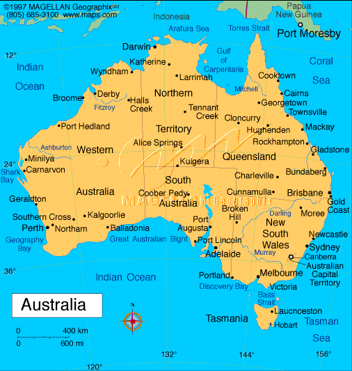
...... population 2,300 and according to its website "The town of Ceduna is located on the Far West Coast of South Australia, on the scenic shores of Murat Bay on the Great Australian Bight, approximately 800kms from Adelaide and 1900 road kms to Perth. It is set amidst a patch work of grain farms, natural bush and rugged rocky bays, secluded white sandy beaches and ever changing seas. Far enough away from bustling city life to keep its pristine conditions and solitude, Ceduna and its region offers spectacular beaches bordered by isolated bushland, giving an unspoilt, uncrowded and uniquely different place to live or holiday".


...all that and more! In December 2002, Ceduna received a huge amount of international attention and thousands of visitors across the globe as it lay in the path of totality for an eclipse of the sun